As the largest archipelago in the world with over 17,000 islands, Indonesia requires a comprehensive set of laws and regulations to ensure the protection, conservation, and management of its incredibly rich marine and fisheries resources.
Ida Ayu Putu Riyastini (Dayu), Head of Marine Resources Surveillance Division at Bali Marine and Fisheries Office, was recently part of the interdisciplinary working group that formulated Bali’s regional regulation on Zoning Plans of Coastal Areas and Small Islands, known as RZWP3K. Under Indonesian law, the management of marine areas up to 12 nautical miles from the shoreline falls under the authority of provincial governments.
An alumna of Australia Awards in Indonesia and the Ministry of National Development Planning/National Development Planning Agency (BAPPENAS)’s Split Site Master’s Program, a dual-degree scholarship jointly funded by the Australian and Indonesian governments, Dayu said it was imperative for each province to have a RZWP3K regional regulation.
“One of the key components to good maritime governance is clear and comprehensive regulations on zoning,” Dayu said.
“It would be impossible to grant permits without knowing whether a development or marine resources utilisation could be detrimental for that coastal area or affect other aspects.”
Dayu strongly believed it was crucial to use an interdisciplinary approach to formulate the RZWP3K regional regulation. She said the Bali Sea was a complex environment with numerous applications to consider, including energy, tourism, cultivation, sea transportation and shipping facilities, undersea cables, as well as defense and security.
Dayu was ecstatic when she learnt that the Split Site Master’s Program could offer her a complementary focus on both coastal areas and environmental protection. The scholarship gave her the opportunity to pursue a Master of Regional Planning and Development with a focus on coastal planning from Universitas Hasanuddin, and a Master of Environment with a focus on environmental protection from Griffith University within two years.
Upon obtaining her degrees in 2019, Dayu, who was working at the Planning Program Sub-division, was assigned to the RZWP3K regional regulation formulation working group at the Marine Division.
“By spending a year at each university, I was able to gain new outlooks that contributed to the formulation of the RZWP3K regional regulation,” said Dayu.
The working group was comprised of various stakeholders, including academics, non-governmental organisations, researchers, and the public, with the Bali Marine and Fisheries Office facilitating the formulation and discussion.
“My multi-disciplinary studies opened up communication with other stakeholders, as I’m able to speak their ‘language’ and understand their data, and to see things from their perspectives,” Dayu enthused.
She was able to apply the critical and analytical thinking skills honed in the master’s programs to connect the various disciplines to the zoning plan, and to be aware of environmental protection and conservation. Biodiversity and marine pollution were some of the issues she learned about at Griffith University that the team considered when they formulated the RZWP3K regional regulation.
The team had to work with a massive amount of data, as the RZWP3K regional regulation is set to cover planning in the Bali Sea for the next 20 years. Gathering, processing, and reviewing data was something that Dayu was already familiar with, but geographic information system (GIS) mapping was a new aspect to consider.
“The knowledge I gained on data mapping using GIS at Universitas Hasanuddin was invaluable, as all data related to the RZWP3K regional regulation is based on GIS mapping,” Dayu said. She also emphasised how studying regional planning and development at an Indonesian university was crucial in providing an Indonesian context.
“Planning and development not only touches on technical aspects, but also socio-cultural. The characteristics of the Indonesian people are very different from that of the Australian people. There are even differences among various regions in Indonesia,” Dayu elaborated.
She and her fellow Split Site Master’s Program alumni were able to compare notes and learn the different Indonesian socio-cultural regional nuances from each other, something that Dayu said would have been impossible to experience at an overseas university.
“At Universitas Hasanuddin, we learnt what can be done within the Indonesian context, while at Griffith University, we learnt the possibilities of what we can do in the future,” Dayu concluded.
Now, as Head of Marine Resources Surveillance Division, it will be Dayu’s responsibility to ensure RZWP3K regional regulation compliance once it is passed. The draft regulation has received technical approval from the Ministry of Marine Affairs and Fisheries and is being integrated with the regional regulation on regional spatial plans.
“Having gained insight from the other stakeholders during the formulation, I see this as an opportunity to spread awareness among businesses, the public, and others who seek various permits within the Bali Sea,” Dayu said.
“By having them understand the reasoning behind the zoning plan, we can ensure long-term compliance, and a more permanent and efficient control, surveillance, protection, and utilisation of Bali’s marine resources.”
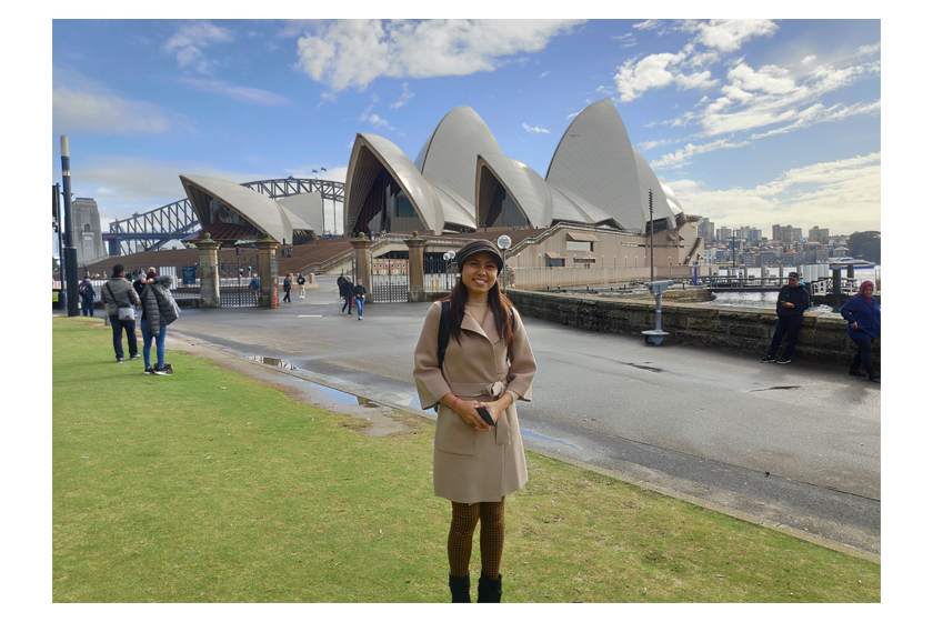
Photo courtesy of Ida Ayu Putu Riyastini.


 Using an Interdisciplinary Approach to Protect Bali’s Marine Resources
